


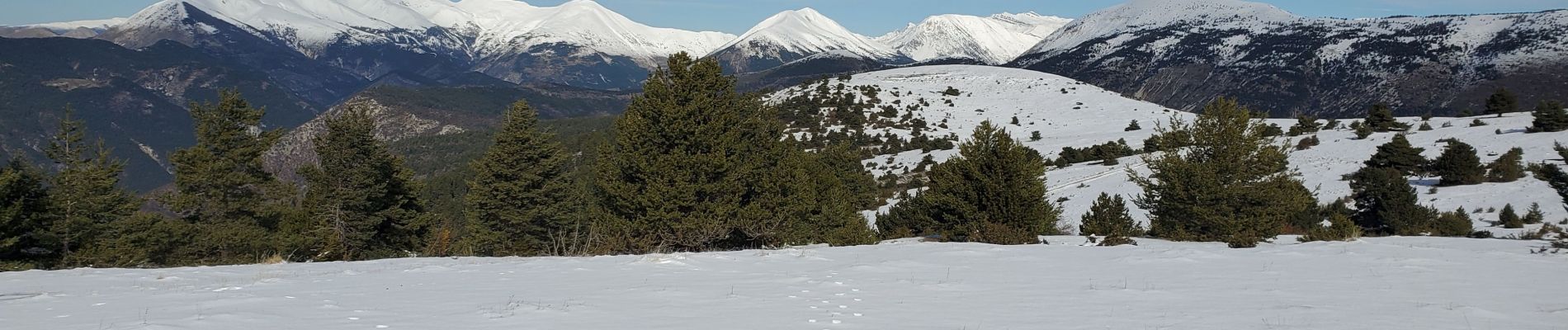
La mure montagne de maurel 950m 14kms

Danielba
User GUIDE
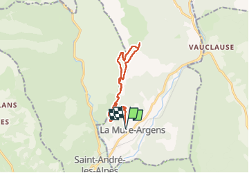

Length
13 km

Max alt
1767 m

Uphill gradient
813 m
Km-Effort
24 km

Min alt
962 m

Downhill gradient
812 m
Boucle
Yes
Creation date :
2024-02-13 07:49:32.222
Updated on :
2024-02-13 16:37:24.672
6h57
Difficulty : Medium

FREE GPS app for hiking
 SityTrail
IGN / Geographical institutes
SityTrail Plus
The world is yours!
About
Trail Walking of 13 km to be discovered at Provence-Alpes-Côte d'Azur, Alpes-de-Haute-Provence, La Mure-Argens. This trail is proposed by Danielba .
Photos


Positioning
Country:
France
Region :
Provence-Alpes-Côte d'Azur
Department/Province :
Alpes-de-Haute-Provence
Municipality :
La Mure-Argens
Location:
La Mure
Start:(Dec)
Start:(UTM)
301307 ; 4872846 (32T) N.
Comments